Tile Server
Advanced Map Server Application
High-performance map tile server for cached and dynamic tiles, static GIS data, and saving published maps. Advanced capabilities include vector-to-raster rendering, tile group blending into one endpoint, and a full searchable API with transactional editing. This release adds Esri Image and Feature Server publishing, custom map styles, release-ready terrain products, cloud-hosted imagery, and faster tile delivery.
Licensed customer? Download full version (signed EXE)
The Perfect Solution for deployment to:
Edge of Battlefield
Emergency Operations/Incident Command Center
Serving data to a secure within firewall On-Premises Environment
Data Distribution Server & COP – Common Operating Picture Map Dashboard
Powerful Flexible Tile Server (from MBTILES) (Serves XYY or WMTS URL’s) Vector 2 Raster and Tile Group Blending/Merging Static GIS File Serving and COG TIF Build in Endpoints and Discover Web Page
Major Release · Signed Build
What's new in this version of Windows Tile Server
Developed with a signed EXE from the latest Artifact Signing Account. This is a significant upgrade — tap or click any item below to view details and preview imagery.
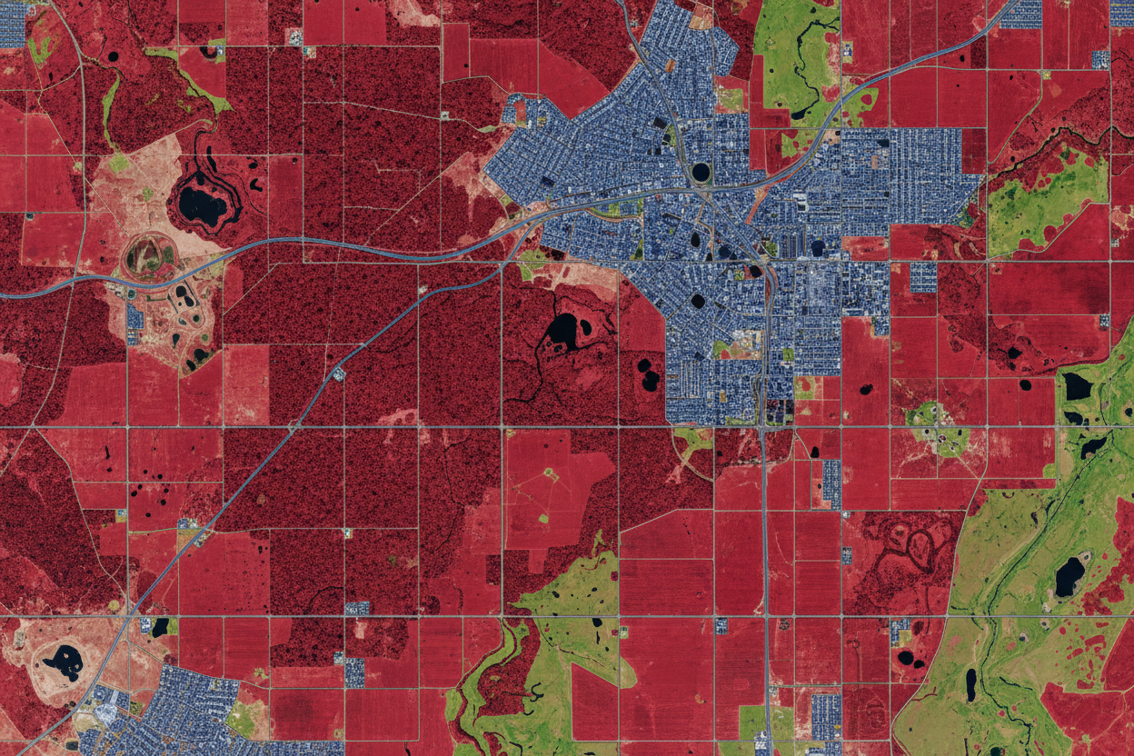

Image Server URLs
Upload a GeoTIFF and Tile Server exposes it as an Esri-compatible Image Server endpoint — multispectral rendering, NDVI-style analysis, and dynamic band ordering via API.
Full-Stack Windows Service · 2D/3D APIs · Offline Ready
Advanced Geospatial Stack for Mapping & Data Services
A complete installable geospatial platform that runs as a Windows service and delivers vector, raster, and 3D data through modern APIs. Designed for offline-first deployments, it enables data processing, analysis, and distribution without relying on external infrastructure.
Vector Data Services
Publish high-performance map services from local files or enterprise databases. Connect directly to PostGIS or GeoPackage to serve dynamic vector tiles, OGC API Features, and ESRI Feature Server endpoints.
Enables real-time querying, spatial filtering, and dynamic styling across all platforms. Ensures low-latency delivery of millions of features without pre-caching — ideal for web maps and desktop GIS integration with full administrative control.
PMTiles Data Support
Bridge the gap between modern cloud-native formats and legacy mapping applications. Host massive PMTiles (OpenStreetMap archives) and expose them as standard XYZ, WMTS, or WMS tiles.
Provides the missing link for systems that cannot read cloud-native files directly. Renders vector data into styled raster tiles on-the-fly, allowing tools like WinTAK and older ArcGIS versions to utilize massive datasets with zero storage overhead.
Image Server & Raster Analysis
A complete suite for aerial and satellite imagery. Ingest GeoTIFF, JPEG2000, MrSID, and ECW to serve ESRI-compatible Image Services with multispectral support and virtual file system access.
Perform dynamic band-ordering and calculations like NDVI via API. Stream terabytes directly from AWS S3 or Azure Blob Storage without moving files locally, enabling advanced analysis through GetSamples and GetStatistics endpoints.

3D Tiles & Scene Server
Power your Digital Twin and 3D visualization. Distribute massive 3D datasets such as SLPK and 3D Tiles for high-fidelity interactive exploration of cities, infrastructure, and mesh terrain.
Converts CAD, BIM (IFC), and 3D GIS data into scalable web-ready services. Deliver dense point clouds, photogrammetry models, and terrain mesh through a standard Scene Server, optimized for Cesium and MapLibre clients.
Tile server windows
Serves local cached map tiles from MBTILES & GPKG GeoPackages
Available as easy to install Native Windows App or MacOSX, Linux App.
Easy to install and Manage
Rapidly Configure data serving, Not restricted to one folder for data you can use any folder that Windows can access.
Serves Map Tiles from MBTILES (any data in the tile_data blob) & GPKG GeoPackage
Serves OGC API Features & Dynamic Vector Tiles
Serves Static GIS Files
Serves COG GeoTIFF
Delivers Map Tiles as OGC WMTS, OGC API Tiles XYZ or OSGeo TMS with tileset.xml
Getcapabilities.xml is provided for /WMTS URL
Tile.JSON are provided
Serve Static GIS Files as URLs to Map Clients
🗸 KML/KMZ
🗸 GeoJSON
🗸 GPX
🗸 CSV
🗸 CZML
🗸 3DTILES
🗸 GLB/GLTF
🗸 TIF/TIFF
Tile server windows
Tile Group (Blending/merging/compositing)
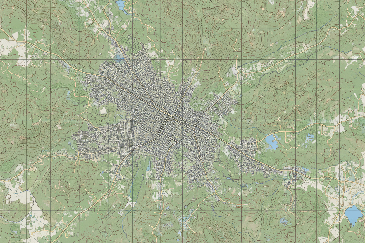
Build Topo /Terrain Style
Build Satellite Hybrid
Other Custom
Tile server windows
Tile Caching for Vector to Raster and Tile Group
optionally create a cache of OSM Vector Tiles for your area of interest/operation to speed up the deliver of data. You can create multiple tile caches and you can delete them or turn on/off as required.

Database Driven Map Rendering
Connect Tile Server to your postgreSQL PostGIS Database Connection and offer:
Dynamic PBF/MVT Vector Tiles with CQL Filtering
Dynamic PNG Raster Tiles with CQL Filtering
OGC API Features (returns html, JSON, GeoJSON) Full Searchable API with CQL Filtering (output to KML as option too)
OGR FDW- Foreign Data Wrapper Postgres can enable connection to local GIS Vector Formats
(Shapefiles, GPKG Vector Features, KML, GeoJSON, GeoParquet, ESRI FileGDB, MapInfo and others)
- Transactional Editing of GPKG Vector features and PostGIS database tables
Load Geospatial data into PostGIS
Easily Configure to run as a Windows Service
Easily configure IP address and port to use
Configure an optional domain and SSL Certificate
Monitor a folder and automatically load new data
Pair with Offline Map Data Generator app to create an MBTILES Tile Cache from these dynamic map tiles for a bbox and minzoom and maxzoom
Pair with Tile Utilities to clip to an area of interest
Pair with Vector To Raster to create MBTILES from the dynamic vector tiles
Cloud Native/Cloud Optimized Data Serving:
- COG – Cloud Optimized GeoTIFF
- COPC – Cloud Optimized Point Cloud
- Flatgeobuf
- GeoParquet
- PMTILES
as http URL for accessing via apps that support range requests and accessing content without downloading entire file
Serve data to ATAK,iTAK,WINTAK Apps
Easy integration /atak zip file or individual tile.xml URL’s
Rapidly serve data to ATAK and WINTAK EUD via Tile Server Windows.
We’ve created the ability to import a zip file of tile.xml of all the tile layers ready to go.
If you have Overlays not basemap put it in GRG folder
ATAK endpoint + tile.xml for ATAK and WINTAK

Serves Pre-Cached Map Tiles in MBTILES & GPKG GeoPackage
🗸 Serves Raster Tiles – PNG, JPG, WebP
🗸 Serves Vector Tiles – PBF
🗸 Serves Elevation/Terrain Tiles (RGB Encoded PNG)
🗸Other – TIF, Terrain Quantized Mesh, LERC2, Other)
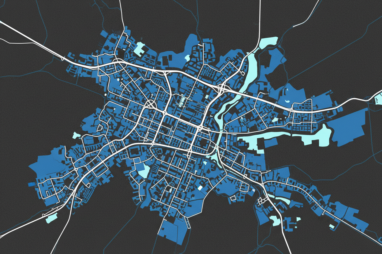
Delivers dynamic PNG Raster tiles from OSM Vector Tiles and can be cached
- This can operate on a laptop or Windows Server. Can deliver data on premises within firewall or for adhoc emergencies and incidents (mobile command center).
- Works with OSM Vector Tiles and rasterizes them to different stylesheets (compatibility with Tech Maven Geospatial data and OpenMapTiles/MapTilerData)
- Supports Caching (building raster tiles) of an area of interest and zoom level range for speeding up performance of the Vector to Raster and Tile Group
- Tile Group – Blend/Merge multiple tile layers
- Tile Group – Build Satellite Hybrid Tiles
- Tile Group – Build Topo/Terrain Tiles with hillshade and contour lines
- Tile Group – Add your own overlays to the predefined styles
- Compatibility with ATAK/WINTAK/iTAK Appps with tile.xml for rapidly configuring tile layers /atak zip file (that includes all the tilexml fles for users to load into their app)

f Tile Server Windows
Edge and Data Distribution Server
Edge and Data Distribution Server (ability to download source mbtiles and source static files)
Endpoint with JSON response /data_distribution
machine readable JSON for easy integration into your application
or use Discover web page to download source files and MBTILES.
Discover web page
Users open this page on their EUD – End User Device in their web browser
to get access to all the URLs


Tile Server Windows
Tile Extents
Show the Coverage of the Data Loading into the Tile Server
Coverage of the tiles you’ve loaded as a GeoJSON Polygon
This is an example to showing QGIS Desktop Application
")
Tile server windows
Vector tile to Raster tiles
for OSM vector tiles
Select a pre-configured styles (compatible with OpenMapTiles/MapTilerData Stylesheets and data generated by Tech Maven Geospatial) or load your own styles up to 5
Now map clients /apps that may not have supported PBF Vector Tiles can consume data.
The other advantage is that OSM Vector Tiles for the world is about 85GB versus 600TB for raster

")
Tile Server Windows
Settings
Works with multiple network adapters and shows all IPV4 IP Addresses and allows Users can select an IP address and port to use. Configure HTTPS secure connection by loading a PFX Certificate and also able to configure a domain name.
Runs as a Windows Service so if VM or physical machine restarts the tile server will start up automatically.
Settings also controls monitoring folder for automatically loading MBTILES
Easy to install (windows application no need to run docker or python or nodejs or configure webserver)
Easy to Load Data – individually browse to tile/files or via text file for bulk loading.
- Optionally Enable loading automatically via monitored folder (any MBTILES placed in this folder/directory will be added to tile server)
Ease of Integration with its built-in API Endpoints with JSON
Visualize the Extends/Coverages of your data with /GeoJSON Endpoint that delivers a GeoJSON Polygon of all the tile layer coverage
Optionally, Automatically restart gracefully and ensure endpoints are available after a computer restart without having to be logged into that profile.
Includes QR Codes on the main screen and Discover web page
Rapidly stand up a Common Operating Picture Map with the included maps that let you configure them with JSON Catalog and serve catalog
Serve DTED DEM Data (dt1, dt2, dt3) as URL
Perfect for ATAK, WINTAK and other mapping apps that use this digital elevation format
Tile Server provides friendly web page to get all the URL’s and machine-readable API endpoints

GPKG- GeoPackage raster tiles (3857) can be supported via first converting to MBtiles with the Tile Utilities App
Esri TPK & TPKX can be supported via first converting to MBtiles with the tile Tile Utilities App
View Samples of the Endpoints available
https://techmavengeo.cloud/software/endpoint_samples/WMTS_GetCapabilities.xml
https://techmavengeo.cloud/software/endpoint_samples/services.json
https://techmavengeo.cloud/software/endpoint_samples/data_distribution.json
https://techmavengeo.cloud/software/endpoint_samples/filelist.json
https://techmavengeo.cloud/software/endpoint_samples/cog.json
https://techmavengeo.cloud/software/endpoint_samples/get-catalogs.json
https://techmavengeo.cloud/software/endpoint_samples/tile_extents.geojson
Tech Maven Geospatial has ready-to-go foundational GEOINT Basemaps, Elevation/Terrain Data and overlays available for your deployment. We also build custom data products to suit your requirements.
We produce on a monthly basis OSM-OpenStreetMap vector tiles MBtiles that are compatible with this app. The file size is about 100Gb for worldwide data (every road, building, land use, point of interest, place, etc) and the styles loaded into this app are compatible.
Quickly find and share urls with our QR code capability
")
")

")

Portable Tile Server iOS and Android also Available